From Stokes, ref. 1. She-Philospher
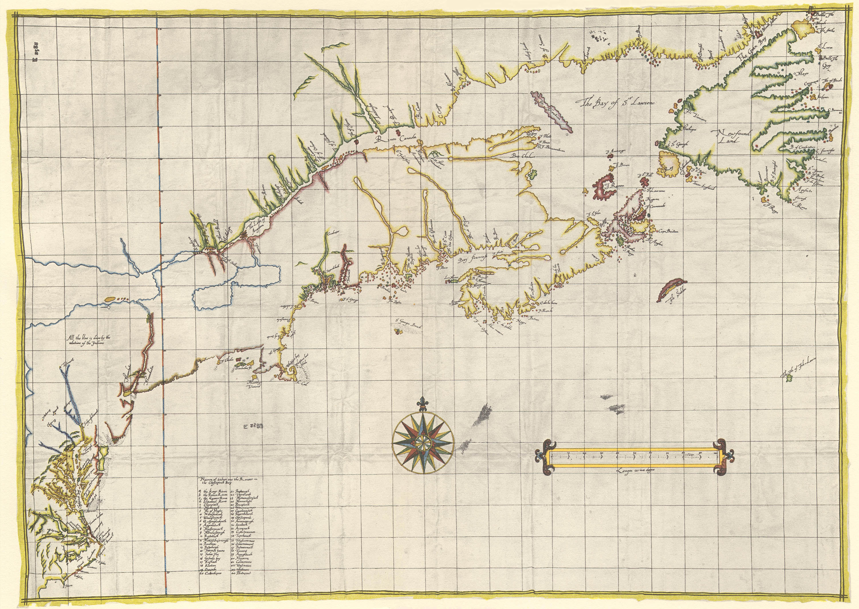
The Velasco Map
(Map of Atlantic Coast of North America)
Anonymous, ca.1610
In 1609 the Dutch East Indies Company (Vereenigde Oost-Indische Compagnie, or just VOC) commissioned the English navigator Henry Hudson to find a northerly route to Asia aboard the Halve Maen (Half Moon). On 3 September he entered the estuary of a river he named “Mauritius”.2 Robert Juet, Hudson’s first mate, described the mouth of the river in his logs:
“The fourth, in the morning as soone as the day was light, wee saw that it was good riding farther vp. So we sent our Boate to sound, and found that it was a very good Harbour; and foure and fiue fathoms, two Cables length from the shoare. Then we weighed and went in with our ship. Then our Boate went on Land with our Net to Fish, and caught ten great Mullets, of a foot and a halfe long a peece, and a Ray as great as foure men could hale into the ship.” 3
On 22 March 1611 Don Alonso de Velasco, the Spanish ambassador to England, sent a letter written in cipher with intellengence on English activities in Virginia to King Philip III of Spain. Enclosed with the letter was a pirated four-sheet manuscript “plan or map of that Province” reportedly made by an English surveyor in 1610 and drawn by an anonymous English cartographer. The Velasco map ended up in the General Archive of Simancas, where it remained forgotten until it was rediscovered by the historian Alexander Brown in 1887.4
The map, a composite of not only English, but French and Dutch information, shows the discoveries of Hudson between Newfoundland and Virginia with close fidelity to Juet’s journals. It is the first map to show the (relatively) accurate course of the Hudson River, which is labelled with the Lanape names “Manahata” and “Manahatin.”
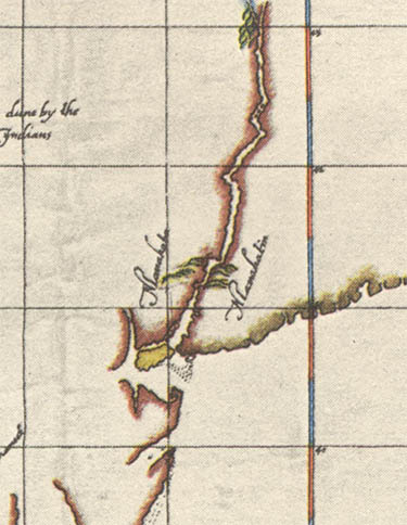
Detail showing the Hudson River
Overall the map presents a remarkably accurate outline of North America. Perhaps too remarkable; as Samuel Adams Drake stated in 1892, “it is entirely too good for the state of discovery at that early period of the seventeenth century.” Early historians, such as Brown or Stokes thought the map to be authentic but current researchers are much more critical, considering it an expert forgery.5 Nevertheless, it remains the only early map of Hudson’s journeys.
5 August 2013
1. Stokes, I. N. Phelps. The Iconography of Manhattan Island, 1498–1909. New York: Robert Dodd, 1915–1928. (6 vol) (online).
The Velasco Map: v2, pl. 22; 67–68
2. For more see: Hunter, Doug. Half Moon: Henry Hudson and the Voyage That Redrew the Map of the New World. New York: Bloomsbury, 2009 (WorldCat).
3. See: Barthel, Brea. Juet's Journal of Hudson's 1609 Voyage, from the 1625 Edition of Purchas His Pilgrimes (online).
4. Archivo General de Simancas, 2588, fol. 25 (Velasco to Philip III, 22 March 1611).
5. See Allen, David. "The So-Called 'Velasco Map': A Case of Forgery?" Coordinates. 14 Feb 2006, Series A(5) (online).