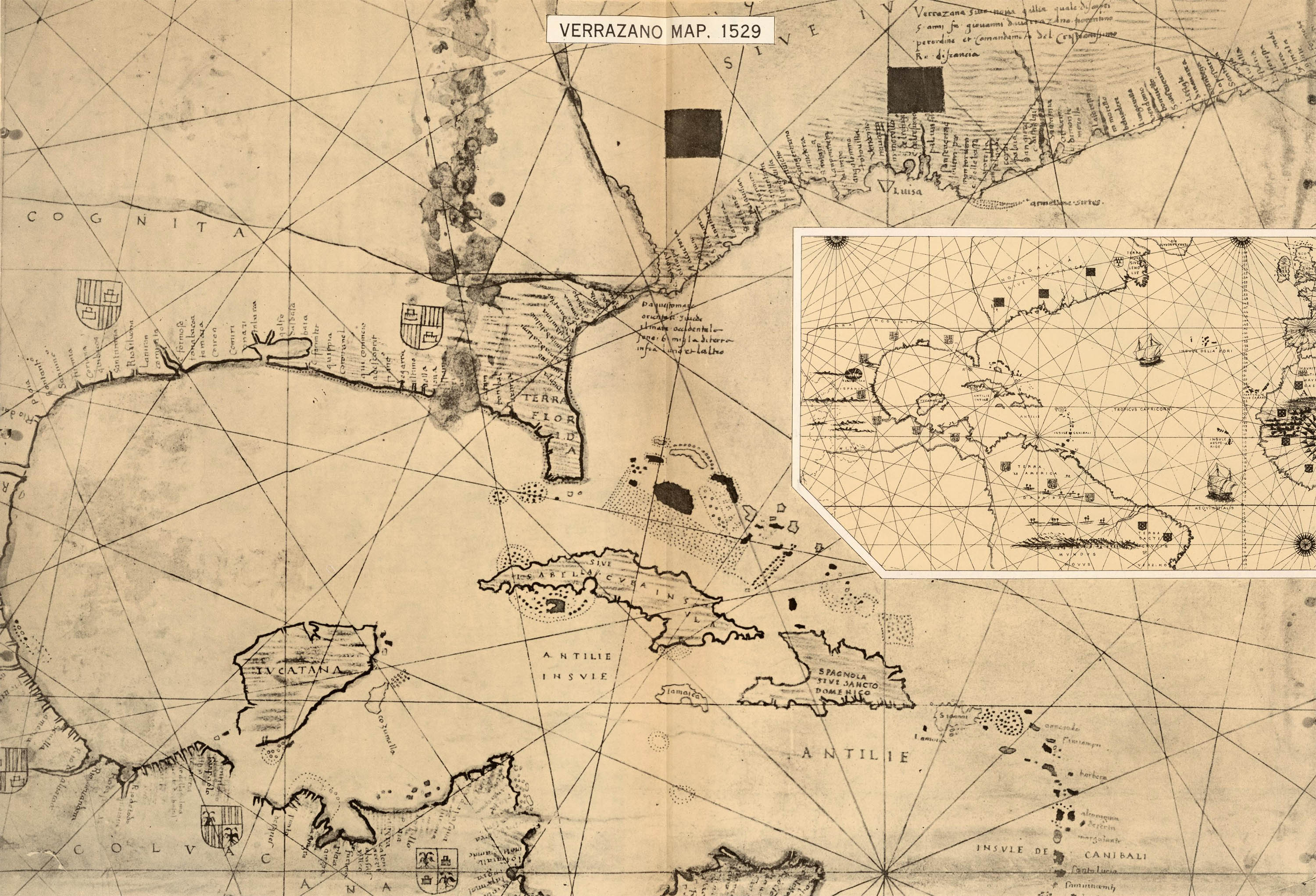
From Paullin, ref. 1. David Rumsey Map Collection
The Verrazzano World Map
Planisfero di Girolamo Verrazano
Girolamo Verrazzano, 1529
The French were rather late to New World exploration and this was proving somewhat concerning to a consortium of Lyonese merchants who feared being put out of business by the more worldly Spanish and Portugese. With the blessing of King Francis I the consortium funded an expedition by the Florentine navigator Giovanni de Verrazzano to find a possible trade route to the East.
Verrazzano (with two z’s – unlike the bridge) set out from Madeira aboard the Dauphine in January 1524 and reached Cape Fear [North Carolina] by March. To avoid trouble with the Spanish already in Florida he turned north, sailing along the Atlantic coast as far as Nova Scotia and possibly Newfoundland. Although he obviously didn’t find a northwest passage to the Orient, he was the first European to see the Lower New York Bay, Block Island and the Narragansett Bay.2
In his letter to Francis I he described New York Bay:
“...So we took the small boat up this river to land which we found densely populated. We went up this river for about half a league, where we saw that it formed a beautiful lake, about three leagues in circumference [the mouth of the Hudson]. Suddenly as often happens in sailing, a violent unfavorable wind blew in from the sea, and we were forced to return to the ship, leaving the land with much regret on account of its favorable conditions and beauty; we think it was not without some properties of value, since all the hills showed signs of minerals.” 3
Verrazzano’s younger brother Girolamo, a navigator and map maker, accompanied Giovanni on all three of his expeditions and charted their new discoveries. In 1529, likely at the insistance of Francis I, he prepared an ink on parchment world map for Pope Clement VII. The map ended up in the collection of Stefano Borgia, perfect of the Propoganda Fide. After Borgia’s death it became part of the Museo Borgiano collection which was transferred to the Vatican Library in the early 1900s.4
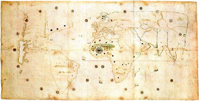
The original manuscript map
The facsimile shown above is from Paullin’s 1932 Atlas of the Historical Geography of the United States.1
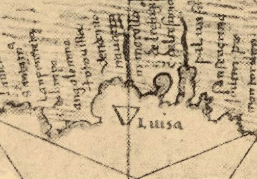
The chart, which significantly skews longitude (the fundamental problem with navigation until the 19th century), shows Verrazzano’s discoveries on the Atlantic Coast with New York Bay named “Angouleme” (Francis I was known as Francis of Angouleme before becoming king), Long Island “Flora,” and Block Island “Louisa.” Girolamo’s outline of North America was, along with a contemporary chart by the Napalese cartographer Adrien Maggiolo, the first to include New York Bay under the French name.
Angouleme, with varying levels of accuracy, persisted on French and Italian maps until Hudson’s explorations in the early 17th century.5
5 July 2013
1. Paullin, Charles; Wright, John (ed). Atlas of the Historical Geography of the United States. Washington, D.C.: Carnegie Institute, 1932. (online).
The Verrazzano Map: pl. 13.
2. See: Wroth, Lawrence. The Voyages of Giovanni da Verrazzano, 1524–1528. New Haven: Yale University Press, 1970 (WorldCat).
3. Letter to King Francis 1 of France, 8 July 1524 (online).
4. Vaticano Ottobiano ms. 2202.
5. For more examples see: Shauger, Fredric. Angouleme, The First European Name for New York, 2008 (online).