The Mannahatta Map
Eric Sanderson, 2009
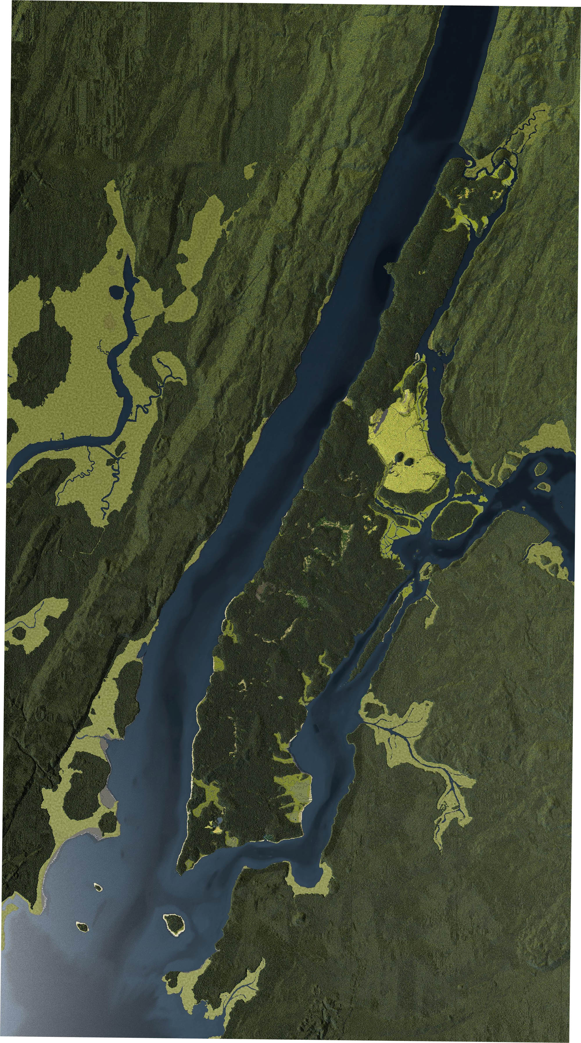
As the Wisconsin Ice Sheet – the last of the great Pleistocene glaciers – advanced south (as far as Staten Island) it leveled hills and bluffs, carved river valleys and sea basins and scoured the soil cover down to billion-year old gneiss and schist. When it receded some 11,000 years ago it left behind enough till and outwash to create parts of Brooklyn and nearly all of Long Island.1
After the last Ice Age temperatures warmed, sea levels rose and the region became densly covered with moss and lichens, then spruce and fir, then pines and birch, and finally maple, oak, and chestnut. These hardwood forests supported large populations of black bear, white-tailed deer, wild turkey and giant beaver. It was a diverse ecosystem that was, as Eric Sanderson notes, “as complex as Yellowstone or Yosemite.”
This natural abundance attracted the Algonquian-speaking Lenape some 6500 years ago. They lived off the land they named “Mannahatta” (land of many hills) by hunting, foraging and later small-scale farming. 2 This abundance, of course, was also what later attracted the Europeans.
The Lenape’s matrilineal society and semi-nomadic lifestyle was completely mystifying to the European exporers who considered them “lazy and barbarous.” As the Rev. Charles Wolley wrote in 1701:
“[they] lived very rudely and rovingly, shifting from place to place, according to their exigencies, and gains of fishing and fowling and hunting, never confining their rambling humors to any settled Mansions.”
Eric Sanderson, a landscape ecologist with the Wildlife Conservation Society, set out to prepare a pre-development map of Manhattan. Using a geolocated version of the 1782 British Headquarters Map, historical records, even rock and soil samples Sanderson and his team spent five years creating a digital terrain model of early Manhattan.3
Being an ecologist Sanderson wasn’t interested in just another topographical map. Using their terrain model his team carefully reconstructed the forensic ecology of the island, identifying 55 different ecological communities and populating it with as many as 1000 different species. Finally by connecting these diverse relationships in a network Sanderson called a “Muir Web” he created the likely habitats of these species, including humans:
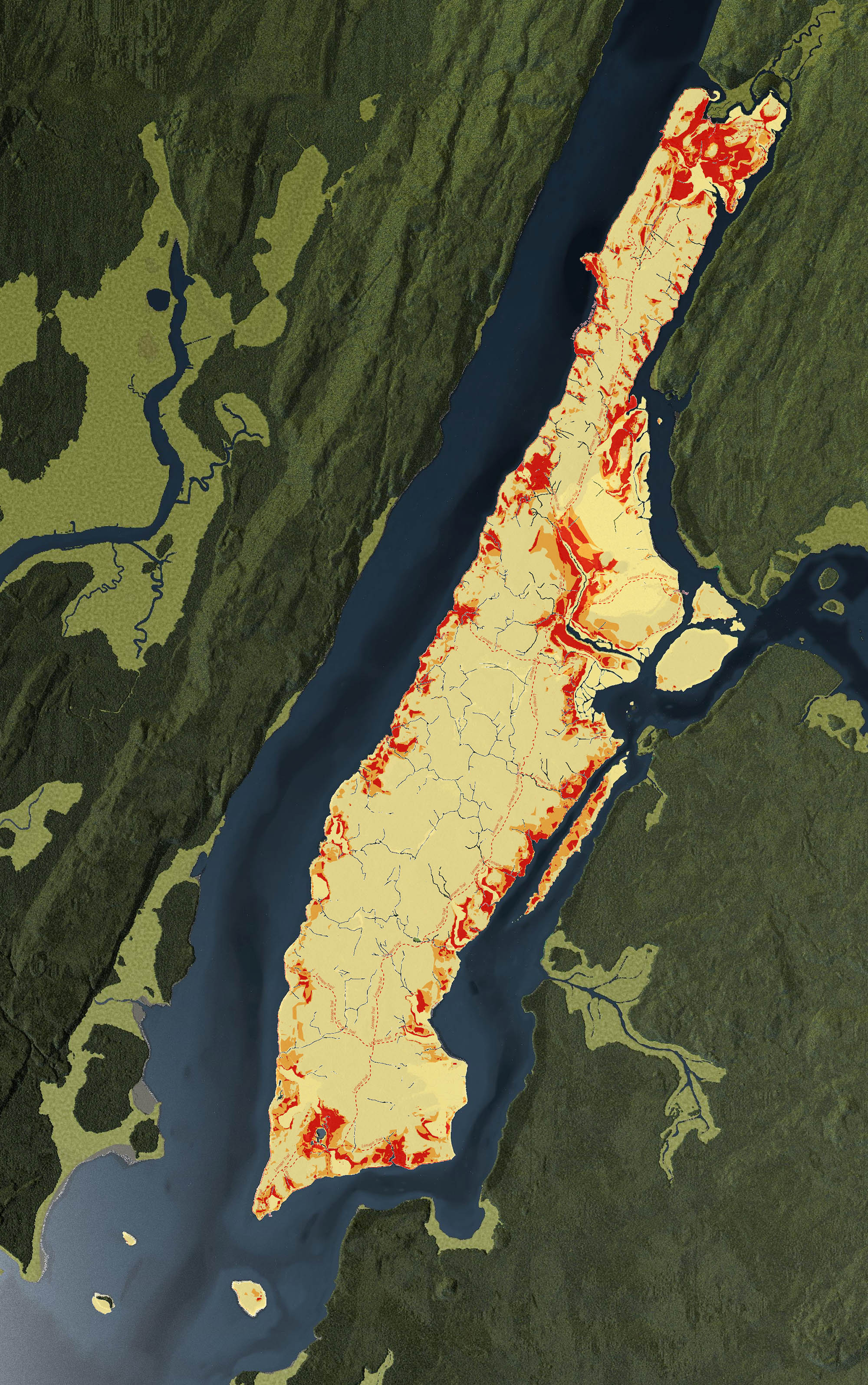
Lenape populations (darker is more likely). Oasis NYC
The 2009 Mannahatta Map completely modelled the historic ecological landscape of the island down to the block level.4 It is, as Sanderson writes, “a view of Manhattan a few hours before Hudson arrived that sunny afternoon four hundred years ago.”
Consider this map a baseline as we began our story.
13 August 2013
1. For geological background see: Isachsen, Yngvar. Geology of New York: A Simplified Account. Albany: New York State Museum, 2001 (WorldCat).
2. For more on the Lenape see: Kraft, Herbert. The Lenape: Archeology, History and Ethnography. Newark: New Jersey Historical Society, 1986. (WorldCat).
3. See Sanderson, Eric. Mannahatta: A Natural History of New York City. New York: Abrams, 2009. (WorldCat).
4. For an interactive map see The Welikia Project.