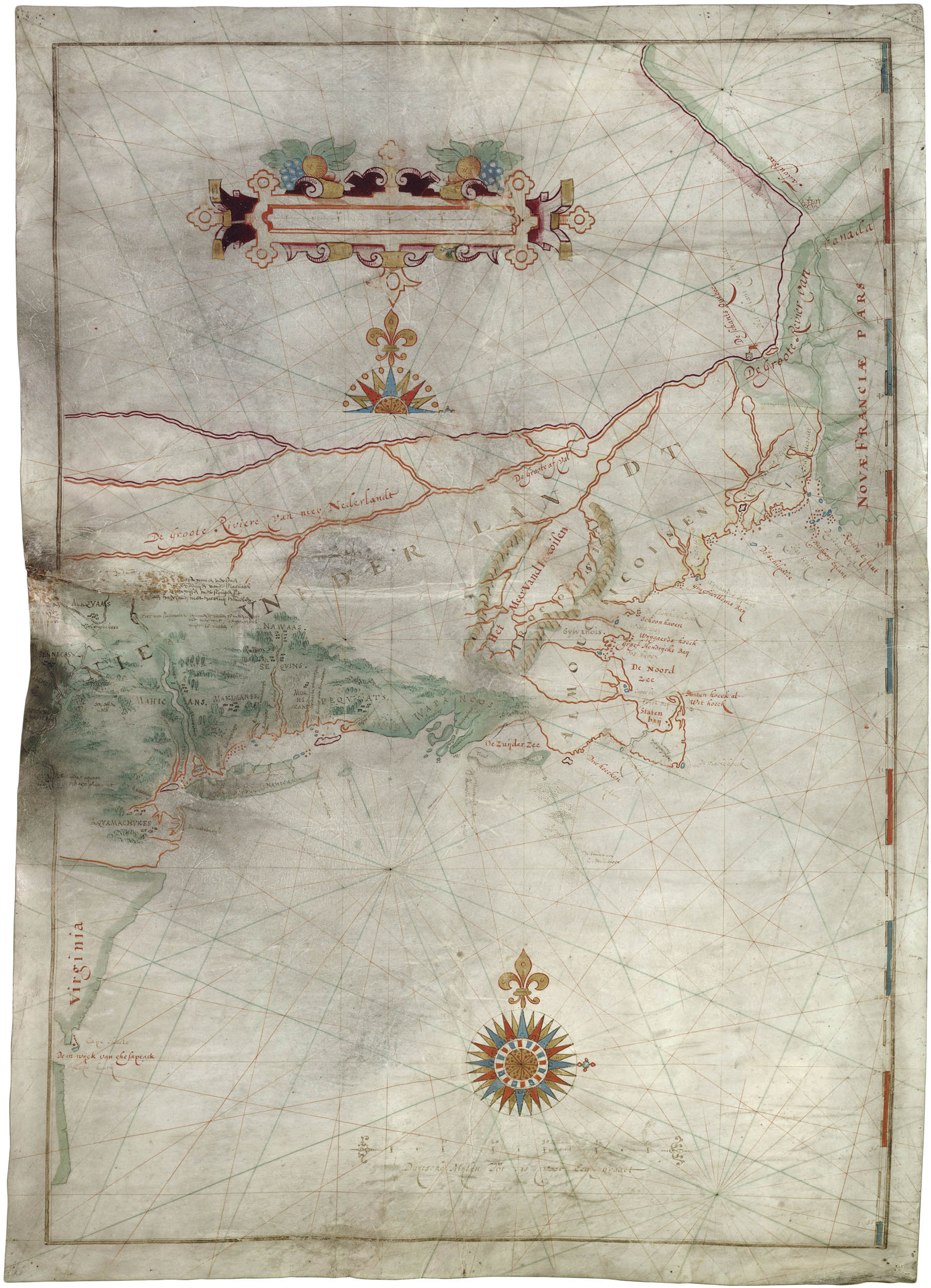
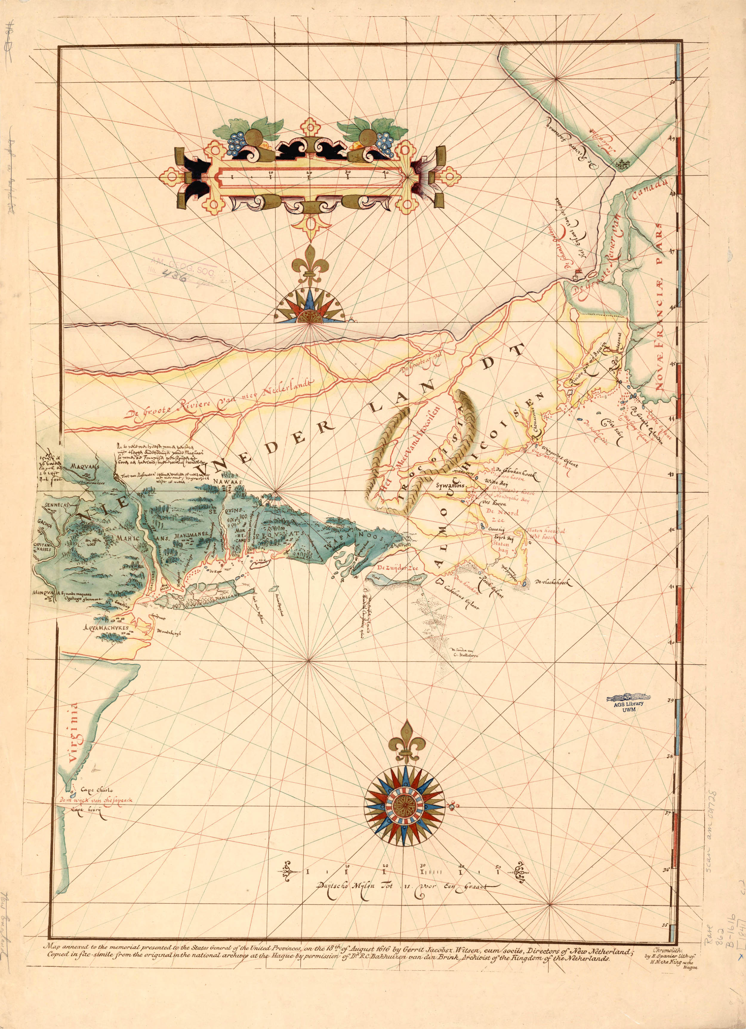
The Block Figurative Map
Cornelis Doetsz/Adriaen Block, 1614
The fur trader and navigator Adriaen Block was among the first Dutch explorers in the region following Hudson. He returned to the region in 1613 aboard the Tijger for what would be his fourth and final expedition to the New World. Preparing to depart for Amsterdam with a cargo of beaver pelts his ship caught fire and was destroyed. Half of his crew mutinied and he was forced to overwinter on (or near) Manhattan Island. He and his remaining crew not only survived the winter, but the help of the Lenape built a new ship, the 16-ton Onrust (Restless).
In the spring of 1614 Block tested his new ship by navigating the East River and Long Island Sound. He sailed as far as Cape Cod, charted the Connecticut River and rediscovered Verrazzano’s “Luisa,” which he named Block Island after himself.
After his return home Block, along with a syndicate of Amsterdam and Hoorn merchants, formed the Nieuw-Nederland Compagnie (the New Netherland Company) which was given a three year monopoly on trade in the new colony. They erected Fort Orange near present-day Albany in 1615 but never bothered to establish any permanant presence.
In 1621 the Dutch West India Company (the Westindische Compagnie or WIC) took over the operation of the colony and petitioned to have New Netherland formally recognized as a Dutch provence. In 1624 their first wave of settlers – thirty Flemish Walloon families – arrived at Fort Orange, High Island and the mouth of the Delaware River.1
Sometime around 1612–13 the Dutch Cartographer Cornelis Doetsz preparted a manuscript map of the Northeast using information from not only the Velasco map, but from Champlain’s 1612 map. Block used this map on his 1613–14 voyage and annotated it with his own discoveries.2 The final ink on vellum manuscript map, prepared by an unknown draftsman, depicted Doetsz’s outline in red and Block's additions in black. It was among the papers submitted to the Dutch States-General to support the charter of the New Netherland Company.
The map, or rather an early copy, was discovered in the Royal Archives at the Hague by John Romeyn Brodhead in 1841 and has been issued in facsimile a number of times since. Here is chromolithograph printed sometime before 1856 by the prolific Dutch firm E. Spanier:
American Geographical Society Library
The map includes the first occurance of the name “New Netherland.” It is also the first map to show Long Island as an island and the first to suggest the insular nature of Manhattan. Along with Cornelis Hendrickson’s 1616 Figurative Map it represents the extent of Dutch geographical knowledge of the Northeast at the beginning of the 17th century.
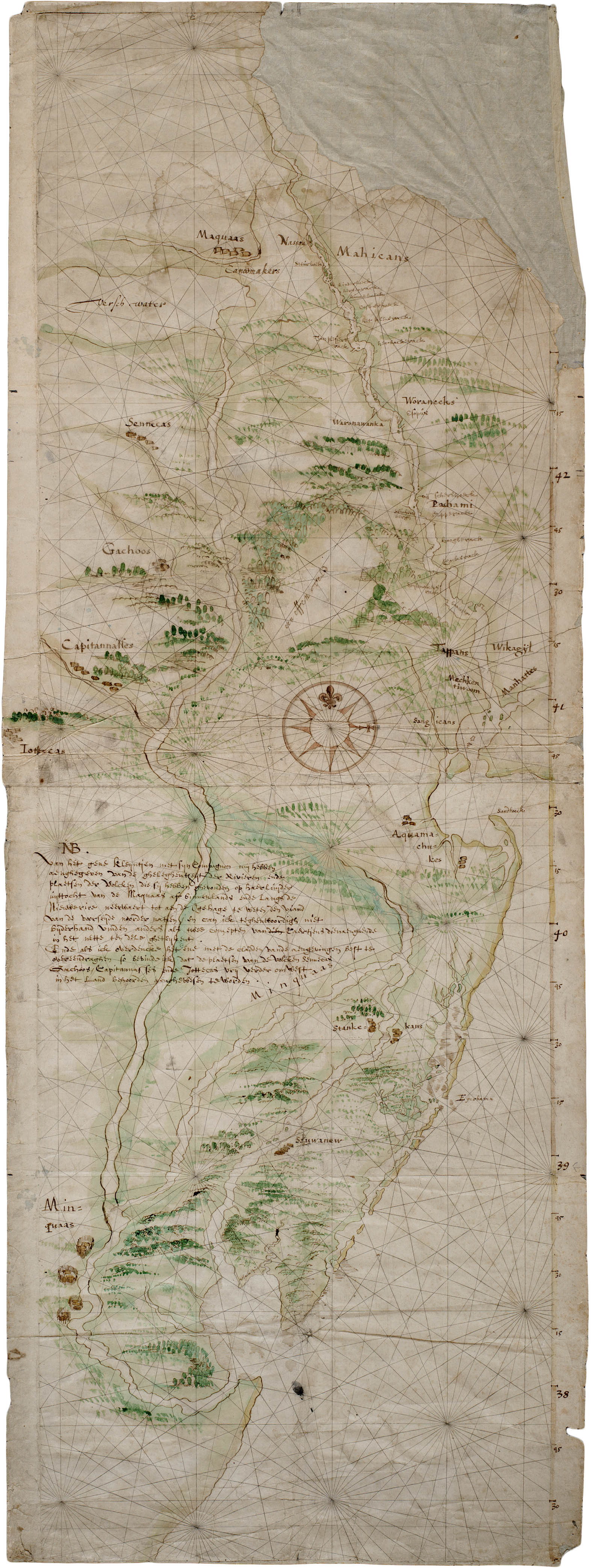
Detail, the Hendricksen Figurative Map. 400 Years New Netherland
6 August 2013
1. For more on New Netherland see: Shorto, Russell. The Island at the Center of the World. New York: Doubleday, 2004 (WorldCat).
For more on the Dutch in America see The New Netherland Institute.
2. See: Allen, David. The Mapping of New York State: A Study in the History of Cartography. 2011 (online).
The Adriaen Block Chart: ch. 1.